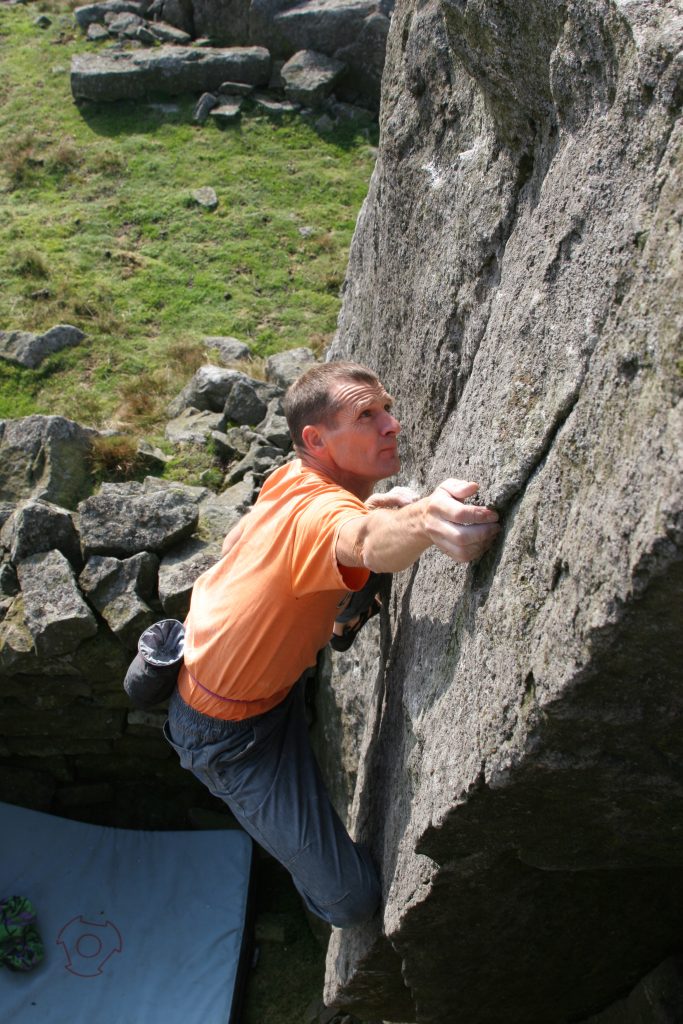
Monk’s Moor and Low Carrs are short gritstone edges and blocks situated in the Hupeshope Valley above Middleton in Teasdale.
Monk’s Moor
Situation and Character
This venue is a collection of boulders and small edges standing at the top of Monk’s Moor, an area of moorland situated north-east of Middleton-in-Teesdale. It is well suited to bouldering. The rock is good quality Gritstone but may still be a little lichenous. The problems have been graded as of their current state. Landings are variable in quality and, generally, a mat would be sensible. The outlook, which encompasses the High Pennines, is superb and, given the westerly aspect, Monk’s Moor should provide a pleasing afternoon and evening venue. So far the obvious lines have given easier or mid-grade problems but the potential for harder variations (especially traverses) suggests some interest for those seeking greater technicality. A visit can easily be combined with the generally more serious and difficult bouldering which can be enjoyed at the nearby Low Carrs (NGR: 948303). A walk across the moor of about thirty minutes duration connects the two sites.
History
Long before climbers explored Hudeshope the valley it was exploited for its minerals and there is an interpretative display and self-guided trail based around Coldberry Mineshop . The most prosperous period of lead mining spanned almost the whole of the nineteenth century, creating one of the largest mine complexes of the North Pennines. This industry transformed forever the landscape of Hudeshope Valley. Scattered around the valley are numerous mine entrances and associated buildings that suggest the extent of the intricate system of shafts and levels that exist below the surface. On the valley sides are reservoirs and the remnants of a man-made water system that was used to power the mine machinery. Coldberry Gutter, the largest hush in the North Pennines, cuts through Hardberry Hill to form a distinctive scar on the horizon that can be seen from miles around.
Alan Dougherty and Kevin Flint visited in late July 2005, when the first twenty-five problems were ascended and recorded. Three subsequent visits, during August of that year, by Carol and Alan Dougherty, resulted in the discovery of a further thirty-four problems.
Access and Approaches
Monk’s Moor is now designated Access Land under the Countryside and Rights of Way Act 2000. Under that Act dogs are excluded currently and the land can be subject to temporary closures of up to twenty- eight days a year. These are likely to be applied for during the Grouse nesting season. Notification of closures should be posted at Access Points locally and, prior to a visit, can be checked on www. countrysideaccess.gov.uk or via the Access Helpline on 0845 100 3298.
The area is covered by several conservation designations. Prior to development our intentions were run past English Nature. Their main concern was the possible disturbance of ground nesting and other birds.
Approach takes a comfortable thirty minutes. From Middleton–in-Teesdale take a minor road northwards up the east side of, the initially wooded and then mine-ravaged, valley of Hudes Hope. The road leaves Middleton-in-Teesdale from opposite the fish and chip shop and is sign-posted Stanhope. After 300m avoid the right turn to Stanhope and continue straight on – sign-posted Snaisgill. Some three kilometres along the road from Middleton –in Teesdale a gate is reached, just before a sharp left bend. Prior to this gate it is possible to park a car carefully on an area of wider verge. A nearby gate gives access to a field east of the road. Walk upslope (roughly east) to a second gate from which an approximately easterly walk of 600m should deposit you at the boulders. By following a line from the second gate towards the left end of the outcrop gives easier going that avoids the deeper heather.
General Layout
Prominent near the centre of the edge is a multi-penned, partly derelict, dry-stone walled Sheepfold that has been built against the SHEEPFOLD BUTTRESSES. The left extremity of the boulders lies some twenty metres north of Monk’s Currick, a round cairn come shelter on the moor above the edge. The furthest right of the boulders THE SHOOTING BOX GROUP lies close to the, also semi-derelict, hut – the Shooting House. All of these three features are marked on the 1:25000 OS map.
Low Carrs

Situation and Character
Low Carrs is a compact location comprising principally of several walls of excellent quality Gritstone up to five metres high. It stands on the southern edge of Middleton Common overlooking the valley of the Hudeshope Beck, both of which lie just to the north of Middleton-in-Teesdale. The outlook is magnificent and the site quiet. A visit can easily be combined with the generally less serious or difficult bouldering at the nearby Monk’s Moor Boulders (NGR 962289). A walk across the moor of about thirty minutes duration connects the two sites. Landings vary from the good to the potentially back-breaking / body-impaling and, given that the lack of traffic so far means some of the rock is lichenous and gritty, a circumspect approach is advised towards some of the problems. Some of the more serious problems have been top-roped and await better conditions for the intended solo. Burly spotters and a selection of mats would be useful. Nevertheless Low Carrs holds some excellent quality wall and arête problems.
History
Carol and Alan Dougherty together with Kevin Flint visited in August 2005, when the first twelve problems were ascended and recorded. The Doughertys added a further seventeen problems during two further visits later in the month.
Access and Approaches
Low Carrs lies on moorland that is designated Access Land under the Countryside and Rights of Way Act 2000. Under that Act dogs are excluded currently and the land can be subject to temporary closures of up to twenty-eight days a year. These are likely to be applied for during the Grouse nesting season. Notification of closures should be posted at Access Points locally and, prior to a visit, can be checked on www.countrysideaccess.gov.uk or via the Access Helpline on 0845 100 3298.
From Middleton-in-Teesdale take a minor road northwards up the east side of, the initially wooded and then mine-ravaged, valley of Hudes Hope. The road leaves Middleton-in-Teesdale from opposite the fish and chip shop and is sign-posted Stanhope. After 300m avoid the right turn to Stanhope and continue straight on – sign-posted Snaisgill. Some three kilometres along the road from Middleton-in-Teesdale a gate is reached, just before a sharp left bend. Amongst other possibilities, it is possible to park a car carefully on an area of wider verge on the right seventy metres prior to this gate.
Walk through the gate and take the track (not the sign-posted footpath) which starts behind a metal vehicle barrier and runs northwards from the sharp bend in the road. The track zig-zags upwards through a large spoil heap to reach some ruined mine buildings. At this point take the left-hand fork and continue through three wooden gates. Just after passing the third gate take a sheep trod on the left, which follows the line of the dry-stone wall across the moor. Low Carrs is reached in about 500m from this last gate, having passed some smaller boulders, one of which might give a bum-scrapping traverse.
General Layout
On arrival the most obvious feature is that of the arête. To its left lies the main wall, whilst further left are the Left and Right Short Walls. To the right of the arête are the dry-stone wall remains of a ruined “hut,” which enclose the side of the hut wall and part of the back of the hut three tier wall. Further to the right is the Elephants Forehead, whilst other problems lie on The Scrappy Buttress just to the right of this feature and on The Isolated Block diagonally right, further up the slope behind. The problems are described from left to right as facing the crag.
Mini Guide PDF

