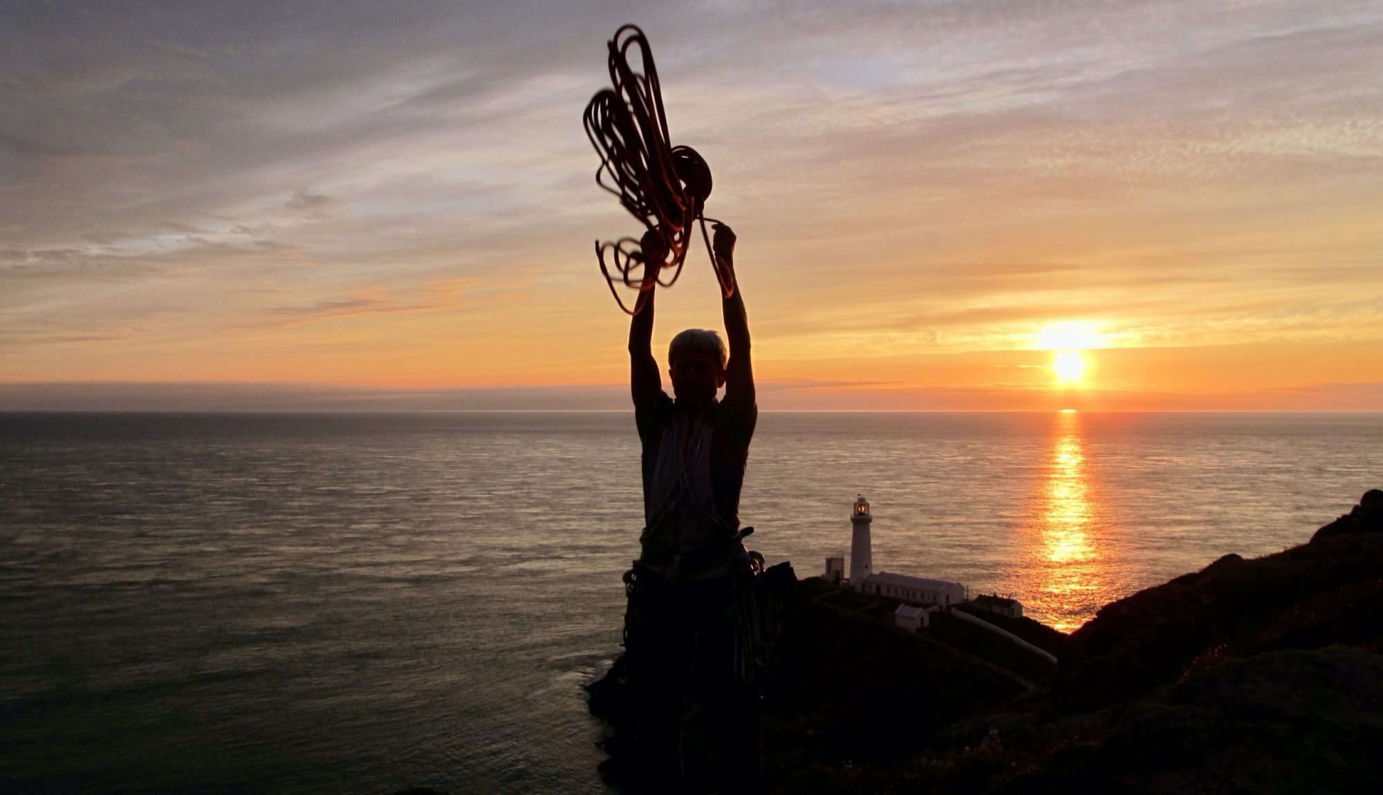
Mike Blenkinsop was the first to record his activities here back in 1974, including Left and Right Walls. Paul Stewart climbed Thin White Crack, The Dancer and the testing Naybrew. Paul Stewart was also involved in the development of the Black Wall with many problems including Improviserand The Rat. Many local climbers have used this compact venue for mid week training but few have “claimed” their achievements as first ascents.
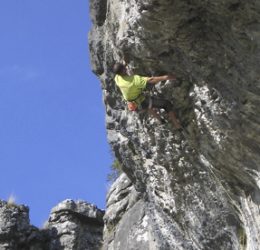
Thin White Crack Font 6A
Situation and Character
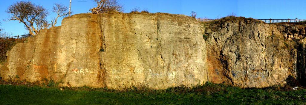
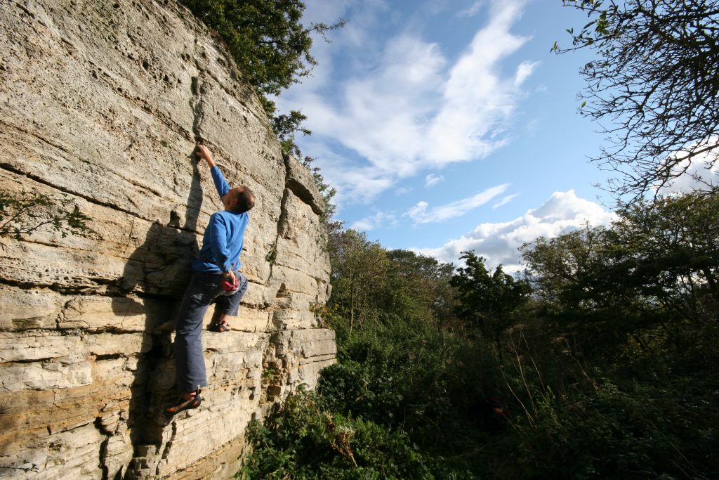
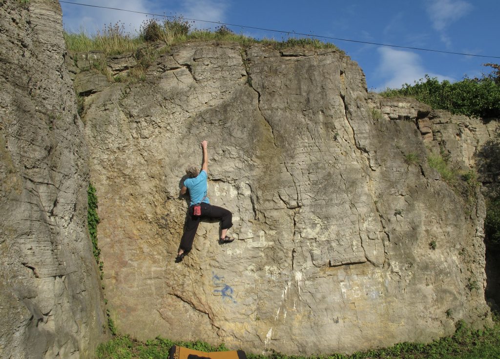
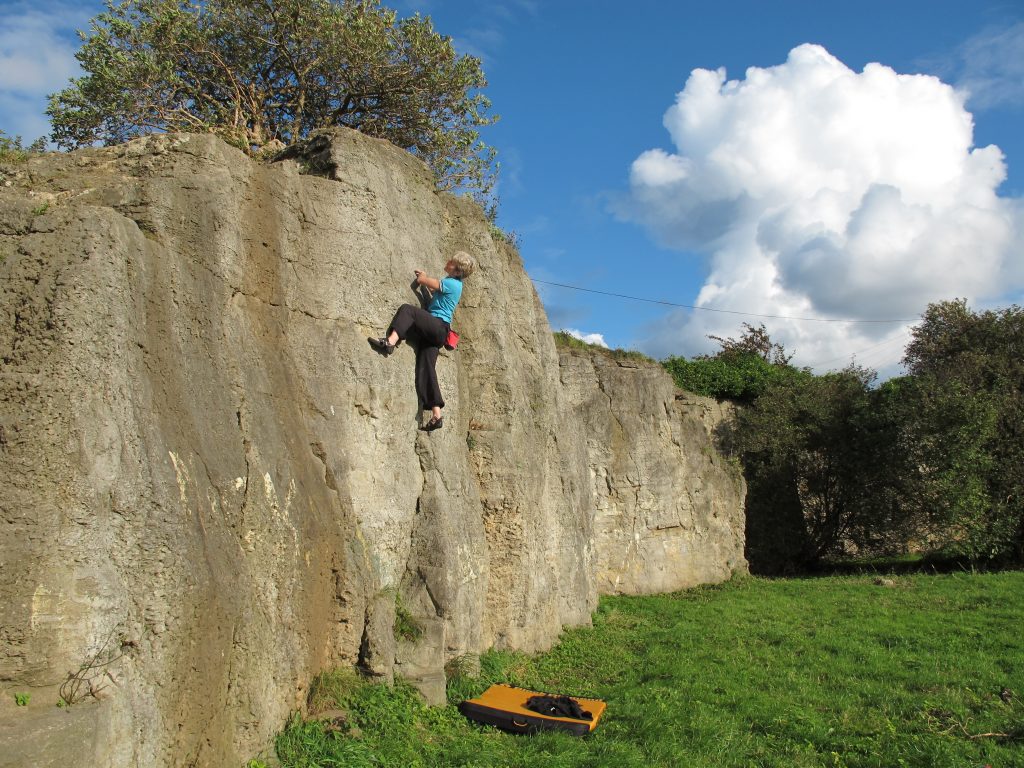
These pleasant, though small, crags are more akin to outdoor climbing walls than some of the major bouldering crags in this guide. The urban setting and southwestern aspect ensures popularity amongst local climbers however a long journey from far outside of South Tyneside can hardly be justified. The rock is Magnesium Limestone with many shell fossils clear to see. The quality of the rock is variable but all the problems described are on good quality limestone, however the more popular problems do suffer from a high polish. Quarry Crag is sheltered and can be climbed on all year round. The nearby Cleadon Crag (NZ392628) has a dozen short solos but unfortunately it is showning signs of neglect and has become more overgrown in recent years.
Quarry Crag is easily located as it overlooks the football fields adjacent to Quarry Lane in South Shields, on the edge of the Cleadon Hills. Park near the junction of Quarry Lane and Larch Avenue.
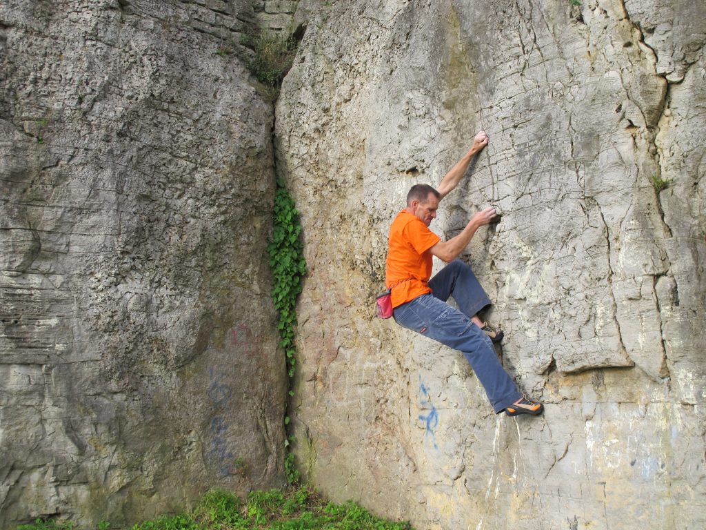
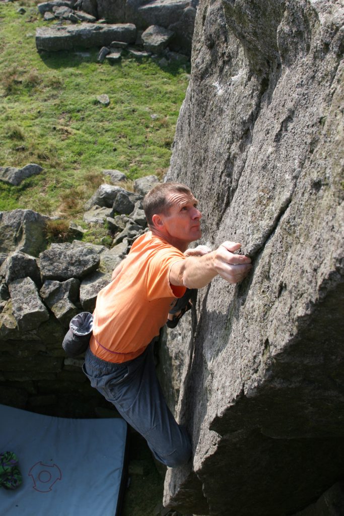
By far the best and most pleasant of the crags in the Cleadon Massif! The problems are short and generally polished. Many of the harder problems are eliminate in nature and obviously many more variations exist than are described here. Despite this Quarry Crag is a popular training area. There are two main buttresses, White Buttress and Black Wall. White Buttress is mostly used for up and down problems while Black Wall is most popular for its pumpy traverses. All the problems are about four metres high. While most climbers boulder here, there is a convenient fence along the top of the crag should a belay be required, however care should be taken not to let the rope run over the edge where irreparable damage has been caused to the soil, especially above White Wall. The climbs are described from left to right.
These friendly south facing gritstone boulders at Sunnybrow deserve to be more popular. They are situated across the moor from Goldsborough and about 30 minutes flat walk from the nearest road.
These descriptions confer no right of access but no difficulties have been experienced during the current development.Both the approaches and the boulders lie within the Danger Area of the Battle Hill Firing Range. Do not enter when red flags are flying.
The present level of development results from visit by Alan Dougherty, Kevin Flint and Paul Johnson during summer 2002. Dougherty and Flint had previously visited circa 2000, when several problems were recorded and no evidence of previous climbing was noted. Scope remains for further problems and several existing ones have only been top – roped so far. Steve Crowe visited in September 2002 and added a few problems and freed one previously top roped line.
Character
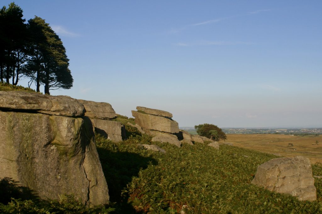
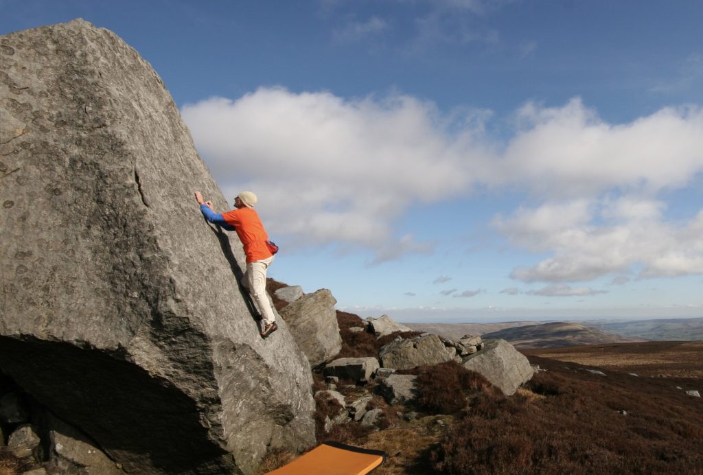
A south facing collection of Gritstone boulders and buttresses, up to 5m high, spread along some 600m of moor side. The Grit is generally of good quality but care needs to be taken with lichen (brushing has been kept to a minimum) and with the odd friable hold along iron rich bands. Many of the landings are good but there are some real ankle crunchers so beware – a bouldering mat is advised. Bracken between the boulders can be irksome but the bases of most problems are clear. Midges can be a nuisance when the wind drops. Generally the bouldering is of good quality and the ambience and outlook excellent, especially as an evening venue. Many of the problems finish with rounded mantelshelves that can feel precarious if the top is lichenous.
Sunnybrow
Approach
Taking the minor road from Cotherstone to Bowes room should be found to park a couple of cars tidily on the north side of North Gill Bridge (GR 996175). Immediately to the south of the bridge a Public Footpath sign points westwards along a well-defined track. This can be followed, passing a gate / style at a sheepfold, for a couple of kilometres to the ruined farmstead at East Loups’. Just beyond East Loups’, the tumbled down wall on the left (south) can be passed, descending slightly from the ridge track way, and the Easterly Group should be visible just ahead. This approach is 2.3km and takes about half an hour. It should be noted that the boulders are not visible until one is quite close. It is also possible to approach from Goldsborough (from where the boulders are hidden from view) by aiming for the gate (GR 964175) where the previously mentioned track (now marked on maps as a Public Bridleway) meets the open moor, near a solitary pine tree.
Monk’s Moor and Low Carrs are short gritstone edges and blocks situated in the Hupeshope Valley above Middleton in Teasdale.
Monk’s Moor
Situation and Character
This venue is a collection of boulders and small edges standing at the top of Monk’s Moor, an area of moorland situated north-east of Middleton-in-Teesdale. It is well suited to bouldering. The rock is good quality Gritstone but may still be a little lichenous. The problems have been graded as of their current state. Landings are variable in quality and, generally, a mat would be sensible. The outlook, which encompasses the High Pennines, is superb and, given the westerly aspect, Monk’s Moor should provide a pleasing afternoon and evening venue. So far the obvious lines have given easier or mid-grade problems but the potential for harder variations (especially traverses) suggests some interest for those seeking greater technicality. A visit can easily be combined with the generally more serious and difficult bouldering which can be enjoyed at the nearby Low Carrs (NGR: 948303). A walk across the moor of about thirty minutes duration connects the two sites.
History
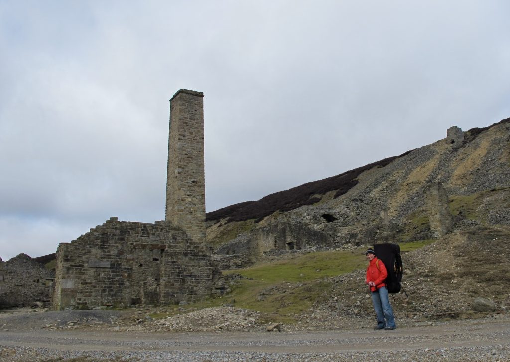
Long before climbers explored Hudeshope the valley it was exploited for its minerals and there is an interpretative display and self-guided trail based around Coldberry Mineshop . The most prosperous period of lead mining spanned almost the whole of the nineteenth century, creating one of the largest mine complexes of the North Pennines. This industry transformed forever the landscape of Hudeshope Valley. Scattered around the valley are numerous mine entrances and associated buildings that suggest the extent of the intricate system of shafts and levels that exist below the surface. On the valley sides are reservoirs and the remnants of a man-made water system that was used to power the mine machinery. Coldberry Gutter, the largest hush in the North Pennines, cuts through Hardberry Hill to form a distinctive scar on the horizon that can be seen from miles around.
Alan Dougherty and Kevin Flint visited in late July 2005, when the first twenty-five problems were ascended and recorded. Three subsequent visits, during August of that year, by Carol and Alan Dougherty, resulted in the discovery of a further thirty-four problems.
Access and Approaches
Monk’s Moor is now designated Access Land under the Countryside and Rights of Way Act 2000. Under that Act dogs are excluded currently and the land can be subject to temporary closures of up to twenty- eight days a year. These are likely to be applied for during the Grouse nesting season. Notification of closures should be posted at Access Points locally and, prior to a visit, can be checked on www. countrysideaccess.gov.uk or via the Access Helpline on 0845 100 3298.
The area is covered by several conservation designations. Prior to development our intentions were run past English Nature. Their main concern was the possible disturbance of ground nesting and other birds.
Approach takes a comfortable thirty minutes. From Middleton–in-Teesdale take a minor road northwards up the east side of, the initially wooded and then mine-ravaged, valley of Hudes Hope. The road leaves Middleton-in-Teesdale from opposite the fish and chip shop and is sign-posted Stanhope. After 300m avoid the right turn to Stanhope and continue straight on – sign-posted Snaisgill. Some three kilometres along the road from Middleton –in Teesdale a gate is reached, just before a sharp left bend. Prior to this gate it is possible to park a car carefully on an area of wider verge. A nearby gate gives access to a field east of the road. Walk upslope (roughly east) to a second gate from which an approximately easterly walk of 600m should deposit you at the boulders. By following a line from the second gate towards the left end of the outcrop gives easier going that avoids the deeper heather.
General Layout
Prominent near the centre of the edge is a multi-penned, partly derelict, dry-stone walled Sheepfold that has been built against the SHEEPFOLD BUTTRESSES. The left extremity of the boulders lies some twenty metres north of Monk’s Currick, a round cairn come shelter on the moor above the edge. The furthest right of the boulders THE SHOOTING BOX GROUP lies close to the, also semi-derelict, hut – the Shooting House. All of these three features are marked on the 1:25000 OS map.
Low Carrs is a compact location comprising principally of several walls of excellent quality Gritstone up to five metres high. It stands on the southern edge of Middleton Common overlooking the valley of the Hudeshope Beck, both of which lie just to the north of Middleton-in-Teesdale. The outlook is magnificent and the site quiet. A visit can easily be combined with the generally less serious or difficult bouldering at the nearby Monk’s Moor Boulders (NGR 962289). A walk across the moor of about thirty minutes duration connects the two sites. Landings vary from the good to the potentially back-breaking / body-impaling and, given that the lack of traffic so far means some of the rock is lichenous and gritty, a circumspect approach is advised towards some of the problems. Some of the more serious problems have been top-roped and await better conditions for the intended solo. Burly spotters and a selection of mats would be useful. Nevertheless Low Carrs holds some excellent quality wall and arête problems.
History
Carol and Alan Dougherty together with Kevin Flint visited in August 2005, when the first twelve problems were ascended and recorded. The Doughertys added a further seventeen problems during two further visits later in the month.
Access and Approaches
Low Carrs lies on moorland that is designated Access Land under the Countryside and Rights of Way Act 2000. Under that Act dogs are excluded currently and the land can be subject to temporary closures of up to twenty-eight days a year. These are likely to be applied for during the Grouse nesting season. Notification of closures should be posted at Access Points locally and, prior to a visit, can be checked on www.countrysideaccess.gov.uk or via the Access Helpline on 0845 100 3298.
From Middleton-in-Teesdale take a minor road northwards up the east side of, the initially wooded and then mine-ravaged, valley of Hudes Hope. The road leaves Middleton-in-Teesdale from opposite the fish and chip shop and is sign-posted Stanhope. After 300m avoid the right turn to Stanhope and continue straight on – sign-posted Snaisgill. Some three kilometres along the road from Middleton-in-Teesdale a gate is reached, just before a sharp left bend. Amongst other possibilities, it is possible to park a car carefully on an area of wider verge on the right seventy metres prior to this gate.
Walk through the gate and take the track (not the sign-posted footpath) which starts behind a metal vehicle barrier and runs northwards from the sharp bend in the road. The track zig-zags upwards through a large spoil heap to reach some ruined mine buildings. At this point take the left-hand fork and continue through three wooden gates. Just after passing the third gate take a sheep trod on the left, which follows the line of the dry-stone wall across the moor. Low Carrs is reached in about 500m from this last gate, having passed some smaller boulders, one of which might give a bum-scrapping traverse.
General Layout
On arrival the most obvious feature is that of the arête. To its left lies the main wall, whilst further left are the Left and Right Short Walls. To the right of the arête are the dry-stone wall remains of a ruined “hut,” which enclose the side of the hut wall and part of the back of the hut three tier wall. Further to the right is the Elephants Forehead, whilst other problems lie on The Scrappy Buttress just to the right of this feature and on The Isolated Block diagonally right, further up the slope behind. The problems are described from left to right as facing the crag.
Situation and Character Perhaps the most remote of all the venues covered in the guide but well worth a visit, this collection of small buttresses and large boulders is situated in a quiet part of the East Pennines at an altitude of over 500 metres. The rock is excellent quality gritstone which has a classic rounded nature and many blind cracks. This gives rise to “smear” problems on both delicate slabs and steep walls. The situation is a suntrap in good weather and a superb quiet setting. A good place to get away from the crowds! It is comfortable to climb here from late spring to early autumn. From a bouldering/soloing viewpoint the landings are not always good, so plenty of pads and spotters could make the day more pleasant. That said and although most of the routes here have been soloed the use of a rope can sometimes be prudent on the bigger climbs.
History Dave Staton whose routes during trips with the Youth Clubs of Darlington included those on Miners Wall and Calver Face was the first record his activities in the early 1960’s. Bruce Perry added routes to the West side of Luckystrike Buttress. Whilst checking out the crag for the North of England Guide, Ron Kenyon climbed a number of routes in 1978. In more recent times, Karl Lunt has climbed many of the existing routes and added some of his own the best of these being On The Level and Karl’s Arête. FRCC stalwart Ron Kenyon is Mr Wobbly. Alan Dougherty continued the development during the 1990’s with his highlight being the The Emerald Isle, which was named by Steve Crowe thinking he was making the first ascent later in the same decade. Bob Bennett, Mark Turner, Steve Crowe and Karin Magog added many more routes and problems during the 1990’s. Of particular note were the ascents of Their Glorious Wealth the first route to tackle the awesomely steep west wall of the Inclined Buttress, the impressive lead of Blood Red Streets and the highball solo ascent of the classic Sin Feinn. Ian Cummings made an impressive onsight solo repeat of Blood Red Streets above a six foot covering of snow.
The best approach is by the old flue running up from the Old Gang Smelt Mills. Park at the popular picnic spot where Surrender Bridge crosses Hard Level Gill. A good level track leads west from here above the north side of the river to reach the old mining ruins at NGR 974005. At this point the ruins of an old flue (looking like an old dry stone wall from a distance) runs directly up the hillside northwards over a number of false summits! The crag is not visible until just before the top of the hill. The flue squeezes between The Lumberjack Wall of the Third Flue Buttress on the left, and The Magic Buttress on the right. The approach as described, although not the shortest, is the estates preferred route and anyway may save time spent stumbling aimlessly across the heather clad moors.
The smooth Skiver 4+ smears up the centre of the slab.